Day 1: Longs Pass to Ingalls Creek Basin
We headed out from the parking lot and up the Longs Pass trail. The trail was clearly marked, as most hikers do this as a day trip to the top, then turn around and hike down the same way. Once at the top of the pass, we were met with an astoundingly beautiful view. I wasn't expecting to see what I saw:
 |
| Mt. Stuart - view from the top of Longs Pass |
 |
| Esmerelda |
 |
| Hike up Longs Pass |
 |
| Top of Longs Pass, preparing to descend. The Mt. Stuart Range an exquisite backdrop. |
After a good night's sleep we woke up, ate breakfast and were packing up camp when we saw a huge deer with big antlers! It was rummaging around eating a few things in the forest. We were being super quiet and didn't want to get too close and scare it away so we didn't get any great photos unfortunately.
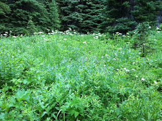
From camp, we hiked west on the Ingalls Lake trail. On the way we encountered stunning scenery, all different types of wild flowers, meadows, and creeks. The Stuart Range was a lovely backdrop throughout our hike.
We reached Ingalls Lake around 9:30 a.m. It's a magnificent, crystal clear blue lake set just below Ingalls Peak. To get to the rest of the trail, we had to hike around the lake. So, we headed to the east side of the lake, through bits of snow (an ice axe was handy here) and did another small climb up some rock to try and avoid most of the snow to the top of the descent trail. However, we were not successful in finding a way off the rock without a rope, and the snow had melted just enough so that it was too thin to walk on to pass over the lake safely, so we ended up hiking all the way around the lake on the west side to reach the trail...bummer. I do not like really like snow, especially in July, this is one of the reasons why... scary and unpredictable! Oh well... we made it but again, added time and elevation to our trip.
Ok, lots of pictures of the lake, but you get the point... it's really pretty :)
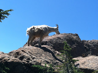
After leaving Ingalls Lake, we started the final push back to the car. The descent from the lake was steep and took a bit of finesse. Once it leveled out a bit, we crossed some snow, a few camp sites and then ran upon the much discussed, but yet to appear on our trip.... GOATS! We had been told that there were tons and tons of mountain goats in the area but we had yet to see one until we were on the way out. We continued along the trail and a few minutes later we saw marmots! Seems like animals wanted to come out to play during the middle of the day.
The final stretch of the day was popping over Ingalls Pass and down-hiking a few miles to the car. As soon as we came over the ridge, there were more goats waiting for us and a super cute baby goat! It looked like a little lamb almost. So cute that I wanted to go pet it and squeeze it, but I didn't because the mom and dad had horns ;) Too bad I can't have a baby goat as a pet, because I think it would be a good one (until it grew up that is).
Saw a few more gorgeous views over the last few miles down, Esmeralda Mountain and Mt. Rainier. Exhausted, battered, a bit bruised, and about 16 miles later (plus 3.1 miles from the 5K we ran in Queen Anne Saturday morning) we reached the car.
We will return to this area for future hikes and likely an attempt to summit Mt. Stuart. It's an enchanting area and I'd encourage anyone to go check it out. There are a variety of hiking trails of all distances and elevations. If you are going to do the same route (or similar) to the one we did, I'd advise an ice axe and some traction device.


